Modeling Firm Estimates German Flood Losses Could Reach €5 Billion

July 30, 2021

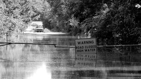
Insured losses from flooding in Germany this month could reach €5 billion, according to modeling firm AIR Worldwide.
Low pressure system Bernd parked itself over central Europe, which caused significant flooding July 13–18. Germany's Rhineland-Palatinate and North Rhine-Westphalia regions were particularly affected, AIR noted, experiencing heavy and, in some cases, historic rainfall amounts.
The border region between the German states of Bavaria, Thuringia, and Saxony experienced localized flooding as well.
Some German rivers, including tributaries of the Mosel and Rhine rivers, reached historically high levels, AIR said.
AIR said that infrastructure restoration such as water and gas pipes, power lines, and roads could take many weeks or even months, according to some estimates, which could lead to loss inflation effects.
AIR said it developed its loss estimates by analyzing hourly precipitation fields over Germany derived from NASA's Global Precipitation Measurement system from July 5 to 19. The modeling firm also used daily observed rainfall data from more than 1,600 gauging stations in Germany.
"As the vast majority of losses for this event within Germany came from the catchments of the Rhine and Danube basins, the loss estimate is limited to these two river basins within Germany," an AIR statement said.
AIR's estimates include losses to insured physical property, both structures and their contents, from both on- and off-floodplain flooding.
AIR noted that other countries, including Belgium, Switzerland, Austria, Luxembourg, and the Netherlands, experienced flooding, but those regions aren't included in the modeler's estimate.
July 30, 2021